Comprehensive Guide to Underwater Surveys in 2023
Underwater Surveys: Understanding the Depths Beneath the Surface
Underwater Surveys are specialized assessments conducted in aquatic environments to gather crucial data regarding various underwater features, ecosystems, and potential resources. These surveys play a vital role in environmental monitoring, infrastructure inspection, geological mapping, and much more. By leveraging advanced technologies, underwater surveys provide insights that are invaluable for scientific research, resource management, and conservation efforts.
Conducting effective Underwater Surveys is crucial for understanding marine ecosystems and assessing environmental impacts.
The significance of Underwater Surveys cannot be overstated, as they contribute to a deeper understanding of marine life and its habitats. From identifying changes in biodiversity to tracking the health of coral reefs, these surveys are critical in maintaining the ecological balance of aquatic environments. Furthermore, underwater surveys support industries such as fishing, oil and gas exploration, and tourism by providing essential data for sustainable practices and regulations.
Underwater Surveys can be categorized into various types, each serving specific purposes and employing unique methodologies. Biological surveys focus on assessing marine life and habitats, while geophysical surveys aim to map underwater geology. Hydrographic surveys are conducted to measure water bodies and understand currents, while archaeological surveys explore submerged historical sites. Pollution surveys monitor contamination levels underwater, enabling proactive measures to protect fragile ecosystems.
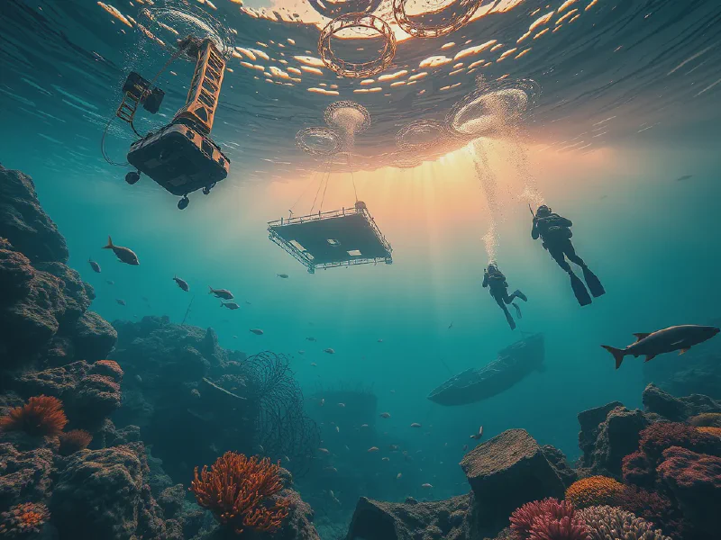
Technological advancements have revolutionized how Underwater Surveys are conducted. Drones and remotely operated vehicles (ROVs) are now commonly used for remote survey technology, allowing for efficient data collection in challenging environments. Sonar systems utilize sound waves to create detailed maps of underwater features, while laser scanning offers high-precision surveying techniques. Camera systems play a pivotal role in biological studies by capturing high-quality images, and GPS integration ensures accurate positioning during surveys.
The benefits of Underwater Surveys extend far beyond data collection; they play a significant role in environmental monitoring, resource management, infrastructure inspection, safety assessments, and scientific research. By regularly assessing the health of ecosystems, surveys help identify changes that may threaten marine life. Additionally, they assist in evaluating the availability of natural resources and inspecting underwater constructions, ensuring safety and compliance with regulations. Scientific research relies heavily on data from underwater surveys to support marine biology and oceanography studies.
Types of Underwater Surveys
Biological Surveys involve assessing marine life and habitats to monitor biodiversity, species distribution, and ecosystem health. These surveys are essential for conservation efforts and managing marine protected areas.
Geophysical Surveys focus on mapping underwater geology, using techniques such as seismic reflection and magnetic surveys to understand geological formations and identify potential resource locations.
Hydrographic Surveys measure water bodies, including depth, currents, and temperature, providing critical data for navigation, sediment transport studies, and understanding hydrodynamics in aquatic environments.
Archaeological Surveys explore submerged historical sites, uncovering artifacts and structures that offer insights into past human activities and cultures. These surveys often involve careful mapping and documentation of finds.
Pollution Surveys monitor underwater contamination levels to safeguard ecosystems from pollutants. These surveys are essential for assessing the impacts of human activities and implementing necessary cleanup measures.
Technology in Underwater Surveys
Drones and ROVs represent significant advancements in remote survey technology, allowing researchers to access hard-to-reach areas and conduct surveys with minimal human presence.
Sonar Systems utilize sound waves to create detailed underwater maps, enabling surveyors to identify various submerged features and capture large areas efficiently.
Laser Scanning in underwater surveys provides high-precision data, capturing intricate details of underwater structures and topography, which is vital for infrastructure inspections and archaeological studies.
Camera Systems, including high-resolution underwater cameras, are employed for biological studies, enabling researchers to capture images of marine life and habitats, essential for ecological assessments.
GPS Integration enhances accuracy in survey positioning, ensuring precise location data is collected, which is crucial for effective mapping and data analysis in underwater surveys.
Benefits of Underwater Surveys
Environmental Monitoring through underwater surveys allows researchers to assess ecosystem health, track changes in biodiversity, and identify human impacts on marine environments.
Resource Management is supported by underwater surveys, as they help evaluate the availability of natural resources such as fish stocks, minerals, and oil reserves, informing sustainable practices.
Infrastructure Inspection is a critical application of underwater surveys, checking the condition of bridges, pipelines, and other underwater constructions to ensure safety and regulatory compliance.
Safety Assessments help identify hazards in marine environments, such as submerged debris or hazardous materials, thus preventing incidents that could endanger marine activities or human life.
Scientific Research is greatly supported by underwater surveys, providing vital data for marine biology, oceanography, and environmental science, advancing our understanding of underwater ecosystems.
Challenges in Underwater Surveys
Depth Limitations pose significant challenges in underwater surveys, as technical constraints limit the capabilities of equipment and personnel to operate effectively at extreme depths.
Environmental Conditions, such as poor visibility, strong currents, and temperature variations, complicate survey operations, requiring specialized equipment and techniques to ensure accurate data collection.
Cost Factors play a crucial role in underwater surveys, as advanced technologies and skilled personnel can lead to high operational costs, posing challenges in budget management for projects.
Data Interpretation is complex in underwater surveys, requiring expertise to analyze the gathered data accurately and translate it into meaningful insights for decision-making.
Regulatory Hurdles can impede underwater surveys, as navigating legal requirements and obtaining necessary permissions for conducting surveys in certain areas can be time-consuming and challenging.
Future Trends in Underwater Surveys
Automation and AI are transforming survey methodologies, enabling more efficient data collection and analysis, reducing human error, and increasing the speed at which surveys can be conducted.
Sustainability Practices are becoming increasingly important in underwater surveys, as researchers adopt eco-friendly approaches to minimize environmental impacts during data collection and assessment.
Integrative Technologies are on the rise, combining various data sources and methodologies to provide a comprehensive understanding of marine environments and enhance the quality of research.
Real-time Monitoring is gaining traction in underwater surveys, allowing for continuous data collection and immediate insights into ecological changes or hazards, facilitating timely interventions.
Collaborative Research is becoming more common, with increased partnerships between scientific institutions, industries, and government agencies, enhancing data sharing and improving survey outcomes.